SpatialGeocomprRstatsLandscape-ecologySpatial-patternsEarth and related Environmental Sciences
Published
Author Jakub Nowosad
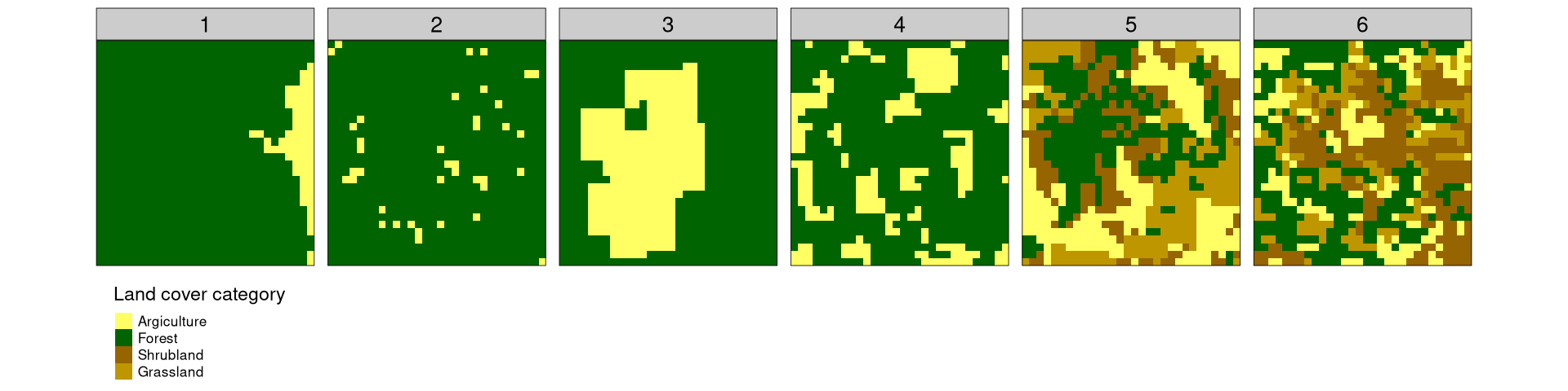
TLTR: Quantifying changes of spatial patterns requires two datasets for the same variable in the same area. Both datasets are divided into many sub-areas, and spatial signatures are derived for each sub-area for each dataset. Next, distances for each pair of areas are calculated. Sub-areas with the largest distances represent the largest change.