SpatialGeocomprSilRstatsLandscape-ecologyEarth and related Environmental Sciences
Published
Author Jakub Nowosad
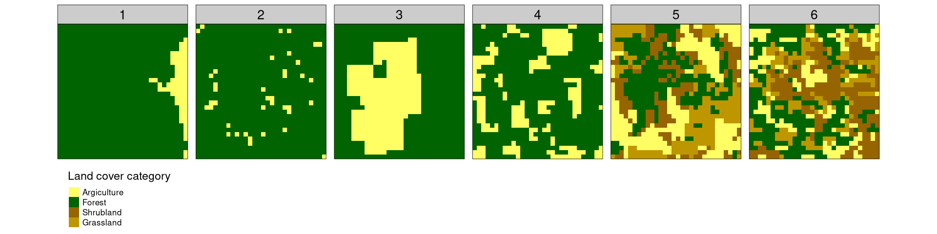
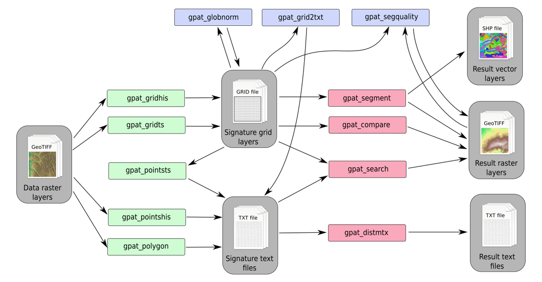
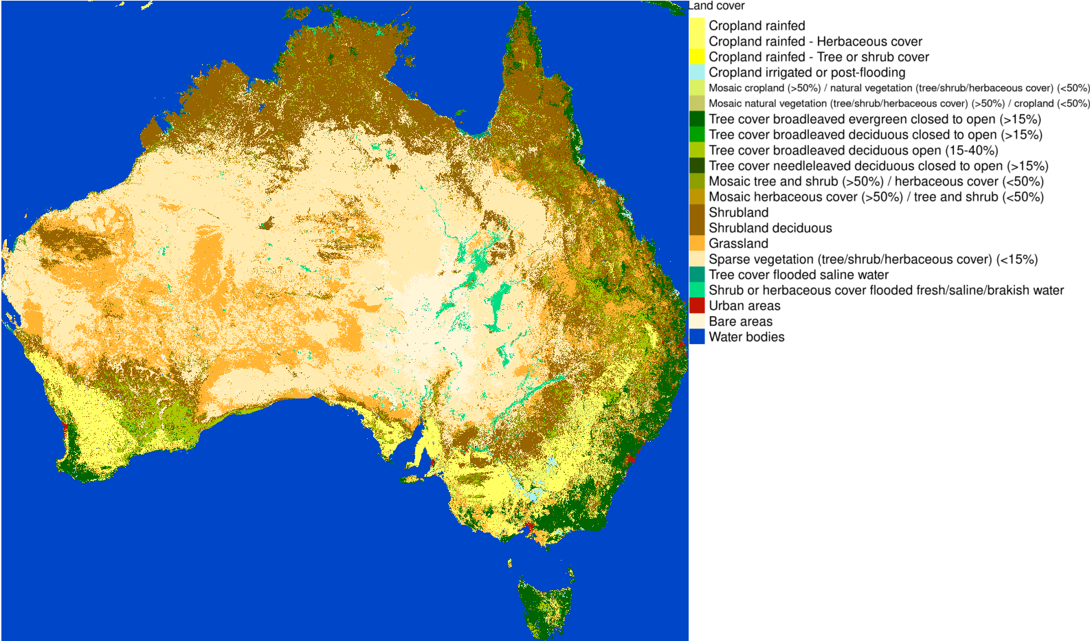
Quantitative assessment of spatial patterns has been a keen interest of generations of spatial scientists and practitioners using spatial data. This post describes Information Theory-based metrics allowing for numerical description of spatial patterns. Each example is accompanied by an R code allowing for reproducing these results and encouraging to try these metrics on different data.